| home |
the project |
henry taunt |
photographs |
the book |
exhibition |
authors |
partners |
images |
maps |
| Catalogue |
|
Click on the links to see the individual pages. The list will be added to by late-December. The lists are arranged in the geographical order from the source of the Thames to the Houses of Parliament. List of photograph-pairs
List of maps
|
|
|
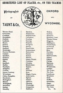
Taunt's list of places for which photographs were available from his
shop
|
 |
|
All images on this site are subject to copyright and permission must be granted by the respective owners before reproduction in any format can be made. This includes the reproduction of maps from Henry Taunt's book 'A New Map of the River Thames', as these have been digitally enhanced by Graham Diprose & Jeff Robins. Copyright © 2007 Graham Diprose & Jeff Robins Permission is granted to copy, distribute and/or modify the text of this document under the terms of the GNU Free Documentation License, Version 1.2 or any later version published by the Free Software Foundation; with invariant sections consisting of all images for which copyright is separately held. Ownership of copyright lies variously with:
Permission is granted to copy, distribute and/or modify the text of this website under the terms of the GNU Free Documentation License, Version 1.2 or any later version published by the Free Software Foundation; with invariant sections consisting of all images for which copyright is separately held. The License may be read here. |
All photographs and their accompanying maps may be seen at the exhibition and in the book.
Our photographic reproductions are processed on archival quality paper, mounted and backed, supplied in a clear sleeve for protection.
Our map reproductions have been printed on archival quality 320 gm cartridge paper, supplied in a bevel cut mount 9.75" x 7" in size, The map and mount will be backed and 14” x 10” in size. It will be supplied in a clear sleeve for protection.
Photographs and maps are available for purchase on this website.
![]()

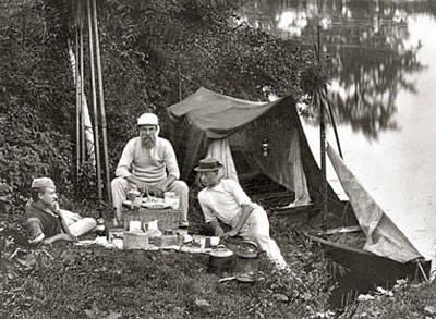
Henry Taunt camping with two assistants
Email contact for copyright issues:
copyright@henrytaunt-footsteps.co.uk

