in the footsteps of Henry Taunt - logo of the book "Thames Revisited" by Graham Diprose & Jeff Robins
home the project henry taunt photographs the book exhibition authors partners images maps
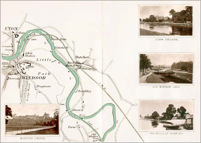
Map 26 - Windsor
Windsor to Datchet & Old Windsor Lock

Map: Windsor to Datchet & Old Windsor Lock, digitised by Graham Diprose & Jeff Robins, copyright Graham Diprose & Jeff Robins

List of maps - from the Head of the Thames to Putney

thameshead
cricklade
kempsford
lechlade
radcot
duxford
newbridge
eynsham
godstow
oxford
sandford
abingdon
shillingford
wallingford
moulsford
goring
whitchurch

caversham
sonning
henley
temple island
hurley
cookham
taplow
water oakley
windsor
staines
chertsey
sunbury
kingston
teddington
richmond
chiswick

top

Outline of the River Thames: the area covered by Henry Taunt’s documentary photographs and maps from the source at Thames Head to the Houses of Parliament