| home |
the project |
henry taunt |
photographs |
the book |
exhibition |
authors |
partners |
images |
maps |
| Inglesham Roundhouse |
|
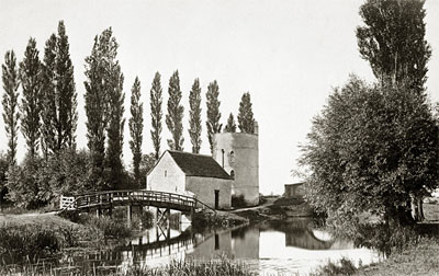
Inglesham Roundhouse c1870
|
|
|
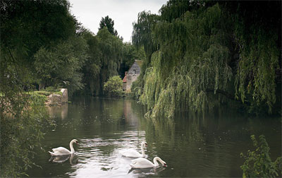
Inglesham Roundhouse 1999
|

|
"Just below is the site of Inglesham Weir, for many years the highest up the Thames; and the river, passing through the old weir-pool, turns sharply to the left under the little towing-path bridge, where it is joined by the Colne from Fairford and also the Thames and Severn Canal, the Round House belonging to the latter being close by. A short reach from Inglesham brings us to Lechlade, where a boat can be left at the wharf close above the bridge."
Henry Taunt 1885
Today, 'the donkey bridge' used by horses to tow barges into the first canal lock has gone. Instead a new bridge spans the main channel of the river, and is part of the Thames Path. Small cruisers owners tempted to exercise their navigational rights further upstream are soon thwarted by shallows and fallen trees, although canoes and punts can make some further headway.
Graham Diprose 2007
See Taunt's image on its original map.
The text above are sample extracts from the book; entries for each location are more extensive.


