| home |
the project |
henry taunt |
photographs |
the book |
exhibition |
authors |
partners |
images |
maps |
| Henry Taunt |
|
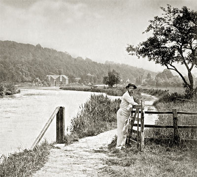
Henry Taunt aged 37 at Marsh Mills, Henley, now the River & Rowing
Museum, Henley c1879
|
|
|
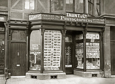
9-10 Broad Street Oxford
|
 |
|
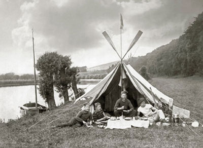
Percy Gordon & friends camping in Harts Wood, c1880
|

|
On the 14 June 1842, Henry William Taunt was born into the modest workers dwellings of Pensons Gardens, St Ebbe’s. In 1856 he joined staff of Edward Bracher, one of Oxford’s very few photographers, as a general utility hand. Over Christmas 1859 he made a solitary trip up river to Cricklade and back in an out-rigged dinghy. The river was in flood, yet here was the moment of inspiration for all the maps, guides, albums and books that were to follow.
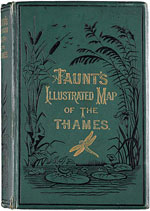
The first edition of Taunt’s ‘New Map of the River Thames’ first appeared
in 1872. The books must  have been difficult to produce, the river was hand coloured in blue on
every one of the 33 maps and each tiny photograph was pasted into position individually. Map pages and printed
text then had to be bound together. However it was an immediate success. As sales of the
“Illustrated Map of the Thames”, various bespoke albums, pamphlets and postcards
soared, there is a strong argument that Taunt had a major role in stimulating the Victorian’s love
affair with the river. A magazine called Home Chimes began to serialise an amusing story of the Thames in
August 1888 and the book version of Jerome K. Jerome’s ‘Three Men in a
Boat’ was published a year later.
In 1893, Henry Taunt was elected as a Fellow of the Royal Geographical Society. This was a considerable honour, no doubt, in recognition of the remarkable feat of cartography and accuracy of measurements that featured in the ‘New Map of the Thames’.
Disaster struck in 1894, when the lease came up on his Head Quarters shop at 9 & 10 Broad Street, Oxford and a verbal agreement was not honoured. Taunt was forced to file for bankruptcy. A few months later, he was discharged and began to work on new ideas for further books and guides documenting many of the surrounding counties of Southern England.
Production was only halted by the First World War and by 1918 Taunt, now an old man of 76, was left with very little help. He died on 4th November 1922. Many of his thin glass images were smashed up while others were cleaned off for use as greenhouse glass. Fortunately E.E. Skuce, who was the Oxford City Librarian, wasted no time in acquiring thousands of surviving negatives, prints and papers. The majority of Taunt's surviving images, over 13,000 negatives and prints, are now held in secure archive conditions by English Heritage and Oxfordshire County Council. Both organizations were exceptionally helpful in locating all of the images that we needed. The River and Rowing Museum at Henley has acquired a collection of Taunt prints in recent years.
We have contributed significantly to the Wikipedia article on Henry Taunt. He is to be found on the list of Pioneers of Photography.


